Thursday, January 27, 2022

NM Trip #28 Part 2: Albuquerque And Fun In The Snow

Page One lies below this entry.  Scroll down to find the real beginning!

PETROGLYPHS NATIONAL MONUMENT:  PIEDRAS MARCADAS CANYON 

This is a northern branch of the main monument, still within the city limits of Albuquerque.  It is seldom visited, and has an amazing display of ancient rock art.  We visited for several hours on a March morning and were all alone the entire time, except for some of nature's citizens.
 
We were both amazed at the astounding quantity and quality of the rock art,the first of two major sites we visited during our visit to Albuquerque.
 
Aside from lizard petroglyphs, there were lizards.
 
Rock art man, with a spiral and hands above.
 
Bird with horns.
 
Raven at the petroglyphs.
 
Jack rabbit at the petroglyphs.
 
Kokopelli with phallus.

Gallery of hands.

An elegant water bird, unusual in desert rock art.
 

RIO GRANDE NATURE CENTER 

This is a restful place, a nature center with walking trails along the Rio Grande in Albuquerque.  There is a welcoming building with observation windows, and just about any nature field guide you would care to peruse.  An entire day could be spent here, inside and out.  Outside there were basking turtles a plenty.  We did 2 1/2 miles of trails in the late afternoon, sat and watched the ponds, and stared at the background mountains.  Afterwards we headed to Marble Brewery, our favourite local. 
 
One of the active ponds at the Rio Grande Nature center, in Albuquerque.
 
Turtle convention.

View of Sandia Mountains from one of the nature center trails along the Rio Grande.
 
The beer board at Marble Brewery, downtown Albuquerque.
 
Old Town, Albuquerque.


CERILLOS HILLS HIKE 

The Cerillos Hills, near the town of the same name, contains my favourite kind of hiking environment, namely the pinon/juniper belt.  Usually located in the 5,000' to 7,000' altitude range in NM. the country is open and expansive, though shelter from wind can always be found at the nearest juniper tree.  The smell of pinon trees, and the smell of the desert earth itself, is usually associated with blue skies and wide open landscape, though usually hilly.  Our hike today took us from Amtrak tracks near Waldo, a siding, to the top of Grand Central Mtn.  We began at 5700' and topped out at 6976'.  It was a beautiful day and a beautiful hike, with a few surprises in store.
We have passed by here four times on the train from Chicago to Albuquerque, and though we heard a train pass today, we were behind the hills and never saw it.
 
    
The Cerillos Hills are actually good sized mountains, except in the west, where they are hills.  Our peak, Grand Central Mtn., is at the right, background.  We began our hike near the cliff shadow in the middle ground, then wended our way upwards to the summit.
 
The GPS of our hike, which was done counterclockwise.  We ascended 1350', walking a total of six miles.  It was a great hike!

At the base of Grand Central, which was not on the original agenda.  Not for the first time, Deb questions my motives and sanity.  The picture is very deceptive; this is a steep and rocky climb.
 
The Ortiz Mountains, from the base of Grand Central Mountain.

Deb on the summit, with Santa Fe Baldy way behind her, and more than 5,000' higher.
 
Summit view west.

Summit view north, again showing Santa Fe Baldy.
 
 
Summit view of Ortiz Mtns., and the beautiful pinon/juniper country surrounding us.
 
It was a tricky descent, and we took a long time doing it.  One loose rock and a nasty spill lay ahead.
 
Deb spotted a beautiful pottery sherd as we walked a canyon back to our car.

Reverse side of above.  We left it where we found it.  A nice discovery.
 
Canyon scenery on our return hike.
 
We followed the Turquoise Trail back to Albuquerque, stopping the former coal mining town of Madrid.  We had coffee, then headed over to our favourite saloon.

Downtown Madrid.
 
Driving back to Albuquerque, we passed the San Augustin Mountains south of Madrid.
 

CIENEGUILLA PETROGLYPHS 

On our last full day we returned to a petroglyph site we had cancelled earlier in the week due to heavy snow.  The snow was now gone but the rock art was still awaiting.  There is a ton of rock art within easy reach of Albuquerque if one knows where to look.  This site surprised us with its variety of art, and the sheer number of glyphs.  Located near a spring, it even boasted a fish glyph!  All week I had thought I was fighting off a cold.  However, today we witnessed clouds of pollen coming from juniper bushes.  I realized I had been suffering badly from allergies. Later in the day I picked up some meds at a drugstore.  Voila!  I felt better.
 
Gallery of Kokopellis.
 
My first fish petroglyph sighting!  There were small wetlands nearby.
 
Rock art gallery.

Large water bird, La Cieneguilla.
 
Petroglyph gallery.

La Cieneguilla petroglyphs.


CERRO SEGURO 

Cerro Seguro is a small peak NW of Albuquerque that we climbed on our final afternoon of adventure.  The peak overlooks a dramatic portion of the Santa Fe River.  We had plans to descend into the canyon (more rock art), but another swift incoming snowstorm ended our hike early.  The soil almost comes alive when wet, and soon turns into a very stick mud.  We sat beneath a juniper bush for awhile, trying to wait out the storm, but it kept on snowing and blowing.  So we returned to our car.  We have unfinished business here.
 
Our hike only lasted for 1.75 miles today, before the storm hit.  We climbed the hill, though, a 500' elevation gain from our car.

View from the summit of Cerro Seguro into the Santa Fe River Canyon.  Our plans to descend into the canyon had to be cancelled due to weather.
 
Summit view SE showing the Ortiz Mountains in the background, and the Cerillos Hills in the left middle ground.  Incoming weather ended our adventure early.

Another view of the canyon we had hoped to enter.  Another time.
 
 
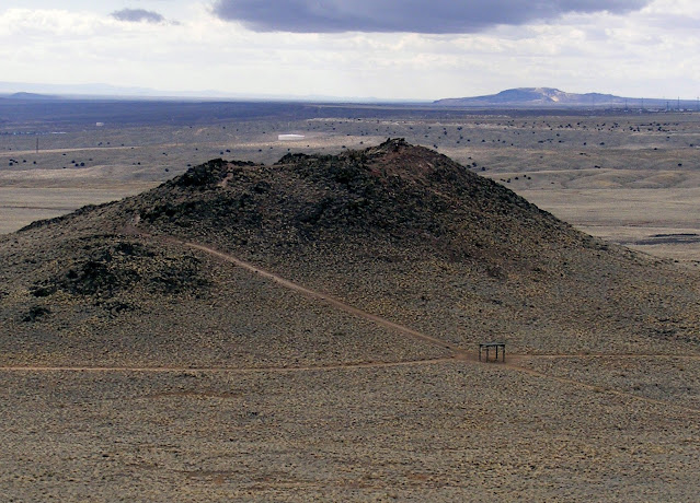
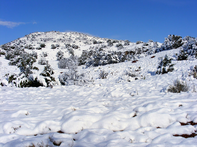
We ended up enjoying 8 hikes that week, totalling 25.3 miles with 4,500' of elevation gain.  Not bad for a pair of flatlanders coming off a meager winter exercise program.  While I enjoyed every single hike this time, I would single out Volcano Hill as my favourite of the bunch.  the blue sky, the wilderness setting, solitude, and hiking difficulty were all perfect.  Next would come the two petroglyph walks, a thrilling reacquaintance for us.  We also had a bit of luck with Deb finding a lovely pottery piece during our Cerillos Hills hike.  In addition, the new snow made for some lovely photo ops!

See you next time for another blast from the past.

Mapman Mike


Monday, January 24, 2022

NM Trip #28 Part 1: Albuquerque And Fun In The Snow

Why am I publishing a trip from 2010 in 2022?  The pandemic, that's why.  I have been unable to get out west for two years now, and the itch is difficult to scratch.  By reviewing and posting some older trips, it is helping me cope with the fact that I am not there, but here.  I hope you enjoy my look back.

Road trips can be of varying length, and I include day trips in that category as well as cross country epic drives.  With the aid of a book called 60 Hikes Within 60 Miles of Albuquerque, we planned our next adventure in March of 2010.  We were based in Albuquerque in a favourite hotel near the airport, having flown in from Detroit.  We rented a basic car, managing to get to all our planned hikes with no problems incurred.  Cold weather and a major snowstorm did not deter us; snow is not uncommon at this time of year, especially north of the city, and in the mountains.  Our 28th adventure in New Mexico would include plenty of snow, stunning hikes, volcanoes, and petroglyphs.  Each trip takes us to new places, with occasional revisits to old favourites.

THE ALBUQUERQUE VOLCANOES 

Lying on a high mesa just west of Albuquerque and the Rio Grande are three prominent, very ancient volcanoes.  Now part of Petroglyph National Monument, it is possible to hike between the two halves of the park.  We stayed up on the mesa today, hiking between the three main peaks.  Our attempt to extend our hike to smaller, further summits was interrupted by a sudden snowstorm.  We ended up backtracking to the car.
 
The view from our hotel balcony includes the summits of five extinct volcanoes.  From L to R: JA, Black, and Vulcan.  We climbed and explored the three southern ones (central one, Black, partially hidden by a pole in photo).  View is northwest from our Yale Blvd hotel.
 
We explored JA, Black, and Vulcan Volcanoes today.  Our GPS track is in blue.  The parking area is at left, at 5731' elevation.  We hiked up to JA first, moving on to Black, then to Vulcan and beyond, before being turned back by a sudden snowstorm.
 
Looking east towards JA Volcano from the parking lot.  This first climb is an easy 150'.

View east to Albuquerque from JA Volcano.  This is the opposite view from the motel balcony, seen above.  Our motel is considerably behind the white building on the far right, background.
 
View of Vulcan, from Black Volcano.  Another hiker up top provides scale.  Vulcan was the largest and most interesting of the three summits visited today.

View back to JA from Black Volcano, looking south.  The parking area is to the right, with Albuquerque to the left.  The mountain in the background is Hidden Mtn.
 
Volcanic arch with lichen, atop Vulcan.

Looking north from Vulcan summit to lower area of the mountain, as well as towards the distant smaller cones we failed to reach.  Our high point today was 6033'.

View east towards the Sandia Mountains, from lower area beneath Vulcan.  While the weather looks great in this direction, directly behind us a storm was beginning.
 

SNOW IN THE MOUNTAINS 

That afternoon and for the rest of the night there was a snowstorm north of the city.  We had plans next day to search out some petroglyphs near Santa Fe, but the deep snow altered our plans.  Albuquerque sits at around 5,000' (same as Denver), but Santa Fe is way up there at 7,000'.  It wasn't our first snowy adventure in northern NM, and it likely isn't our last.
 
Sunset on the Sandia Mountains, from our hotel balcony.
 
Next day a winter wonderland awaited us near Santa Fe.  Our hike to see ancient rock art has to be postponed.
 
This was our trailhead for our planned hike!  We postponed it till later in the week.
 
 
Despite having to cancel today's morning hike, we enjoyed a very scenic drive.
 
Santa Fe Baldy, center, towers over the surrounding Sangre de Cristo Mtns.
 
What are two roadside adventurers to do if hiking is off for now?  Perhaps have lunch at a famous NM brewery!
 
Refreshment at 7,000'. 


TENT ROCKS NATIONAL MONUMENT 

The afternoon hiking session was still on!  The snow at Tent Rocks hadn't been intense, and it melted quickly.  So after lunch we headed to one of NM's most scenic areas, up near Cochiti Lake, northwest of Albuquerque.  Easily reached by good road, there is a parking lot with interpretive signs, and two excellent trails for hikers.  We hiked both trails, enjoying one of the most unique hikes we have ever undertaken.
 
Deb signs the register at Tent Rocks National Monument.  Look up.  Look way up.

Official tent rock greeters were at the trailhead.
 
The trails were very scenic, and not very busy.
 
Ever wonder what the upper tree roots of a Ponderosa Pine looked like?
 
From the park brochure.  We hiked both trails.  Slot Canyon Trail tops out on a high ridge.
 
Inside Slot Canyon.

Our first petroglyph of the journey.
 
 
It may not be the Sistine chapel, but it's awful pretty here.
 
The trail gets quite narrow in places.
 
Mapman at the top of the Slot Canyon Trail.  The summit was narrow and small, and drop offs were extremely hazardous.

Tent Rock family.
 
King of the tent rocks.

There are a lot of tent rocks around here.


VOLCANO HILL 

Located about 40 miles southwest of Albuquerque,v once back here it seems as if you are alone in the world.  This is a common theme on most of our hikes in New Mexico.  We usually encounter no one else, and today, our fourth one near Albuquerque, was to be no different.  Volcano Hill tops out at 6607', and we parked at 6101', enjoying a short but steep, rough climb to the summit, and then around the crater top and into the crater itself.  The drive is fairly long, all dirt once leaving I 40, much of it covered in washboard.  This means a slow, very bumpy ride.  Singing long notes as we bounced along became a fun pastime.  There is no trail, but the entire mountain is open for exploration.  Our route is detailed on the map below.
 
Volcano Hill rises 500' above our parking area.  This was a really fun half day adventure! 
 
Our GPS track laid overtop an All Topo map.  We hiked the crater counterclockwise.
 
Deb meanders her way towards the summit of Volcano Hill, early in the climb.
 
Looking back down to our tiny rental car, at 11 o'clock to the small pond left of the others.  The car looks like two close, tiny dots.  At upper left, across the road, is Cerro Verde, a much larger and higher volcano.  We saved this one for a future climb (and we did it!).
 
Summit view, looking NW towards snow-capped Mt. Taylor. We have climbed that volcano twice now.
On today's hike we followed the crater rim, seen well here, after leaving the rocky summit, and then headed down (left) into the crater remnant.
 
Our only selfie of the trip.
 
Telephoto view of Mt. Taylor from Volcano Hill.
 
The summit had very dark rocks, and one redheaded hiker.
 
Welcome to Mars!  Terraforming has began.  This is a view of the Petaca Pinta Wilderness, looking west from the summit of Volcano Hill.
 
We descended into the cone, discovering a perfect example of petrified wood.

A volcanic rock noticed on the descent slope of the inside crater.  As a special bonus, I have included Deb's thumb.
 
A final summit view, looking northeast.  Note the ghostly Sandia Mountains in the background.
 
PAGE TWO coming soon....


The Deep South: Part 5: New Orleans

NOTE:   This blog is in 5 parts--scroll down to begin at Part 1!   It was Monday, and Day 7 of our trip.  It was finally time to spend a da...