Please read part 1 and 2 first.
DAY 5
We were in Arkansas, at the border with Oklahoma, just across the Arkansas River. Today we would leave Fort Smith to visit a prehistoric earthwork site in Oklahoma, the first of two such sites planned for this trip. I was very excited as we checked out of our hotel for the short drive across the state line. I had heard of Spiro Mounds many years ago, and on visits to the Gilcrease Museum in Tulsa we had come across many original artifacts from these mounds. The art is absolutely astounding, but the local museum at the site has only replicas. Sadly, the Gilcrease Museum is closed until 2025. They are building a newer, bigger Gilcrease. Can't wait for that!! In fact, as an interesting aside, the Crystal Bridges Museum is housing the Gilcrease permanent collection in their storage vaults, and showing a few of those pieces of art from time to time. How do you like that, Wal-mart shoppers?
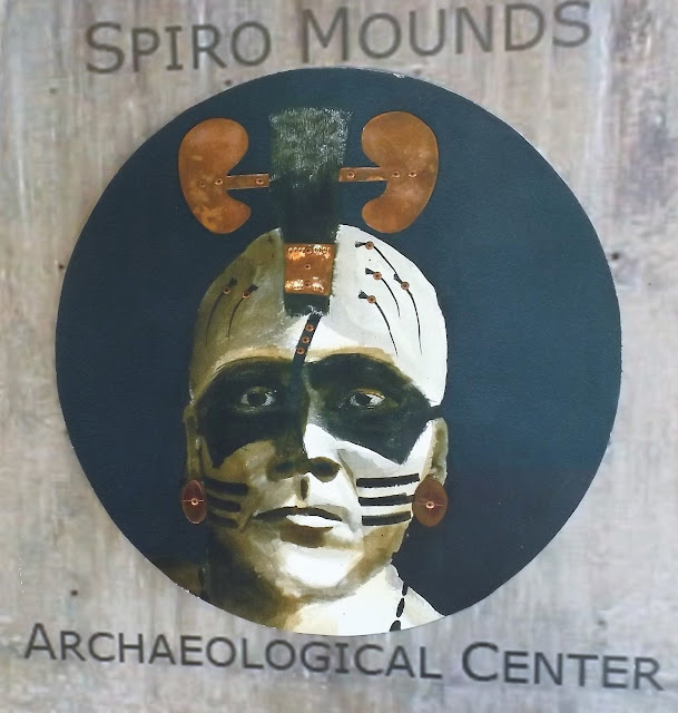
A painting depicting a raccoon warrior from Spiro Mounds. Several contemporary paintings adorn the museum, including a large mural, all based on original artifacts unearthed here.
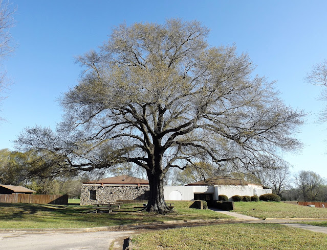
The welcome tree and museum building at Spiro. It was sunny, but a chilly wind was blowing.
A model inside the museum showing the museum, mounds, and marked trails. We walked all of them today. This is a huge site, well worth a visit.
Many of the mounds discovered here were house mounds, with small structures built on top. One of the reasons I love to visit these sites is to try and imagine what life might have been like here in the heyday. Certainly not primitive by any definition, despite what early explorers believed.
A mostly falling down reconstruction of one of the houses built atop small mounds.
Approaching the remains of one of the large mounds. A great deal of looting occurred here in the 1930s, before any conservation laws were established. The mounds were dug into and practically destroyed.
Prickly pear cactus was discovered on the nature trail.
We explored most of the mounds, and took a walk into the woods on the nature trail. What a mistake that was! I doubt Crocodile Dundee could have made it through here, but Deb and I just managed it. Downed trees and branches, flooded sections, and really bad thorny things everywhere off trail keep us busy overcoming the odds of survival. At one point I was completely stuck in thorns, crouched low and unable to move forward or backward. If I had been alone, I would have been stuck there until who knows when. But Deb managed to struggle over to my location and partially free me from the entanglement. Ripped clothing and skin were our rewards for tackling this trail, plus that special feeling of accomplishment. The hardy expedition continued for some time before we emerged (scratched and dented) back on safe soil. That's nature (and her trails) for you.
Not much remains of a busy city today. Overview of the mounds and trails. Brown mound was the main ceremonial mound.
Like many prehistoric sites around the world (not just Stonehenge), solstices were important events. By standing at the center of the Brown Mound, equinoxes and solstices could be marked exactly by careful sighting with other mounds.
Of over 2,000 prehistoric archaeological sites in Oklahoma, this is the only one open to the public. And this one is looked after by one employee. What does that tell you, dear reader, about Oklahoma and its funding model for its ancient history? I highly recommend that readers Google "Spiro Mounds Artifacts" to see the kinds of things that were created here when the site was occupied by the mound builders, from around 800 to 1450 AD. The Wiki article about the site is also quite good.
We spent the morning here, and were soon speeding back across the Arkansas River into Arkansas again. We were heading for our second State High Point of the journey, and the one in Arkansas promised a bit more drama than the one in Indiana. The state high point is atop Mt. Magazine, on a thickly forested knoll up there called Signal Hill. We drove towards Paris, AR, stopping for a take away Subway sandwich in Charleston. Deb went in and was served by a young gentleman Elvis. We were going to take our food up the mountain to eat at a picnic area near our hike.
From several miles away we could see the mountain. It was very big, rising up from the land like a distant whale. In Paris we turned south on AR 309, a classic winding two lane highway that climbs up the north side of the mountain before dropping down on the south side, ending at Havana (there certainly are some interesting town names along the way in these here parts). It only took about 20 minutes from Paris to reach our picnic area near the top of the mountain. It was quite chilly up top, and of course a stiff breeze was blowing. We ate our lunch alone in the grounds, then headed across the road to Mt. Magazine State Park (lunch was taken in a national forest), where a large, modern welcome centre awaited. We got free park trail maps, purchased a hand made stick-cane for Deb, and I got a state park pencil and a high point pin for my hat. What a haul! It was a short drive along a paved forest road to the parking area for our petite hike to the top of Arkansas. Only one other car was there, and that party was just ending the hike as we set out. Being a Saturday, I had expected hordes of people, but it was pretty quiet.
The blogger himself, prepared to hike to Arkansas' highest point. What a lovely day it was!
Deb with her new stick-cane heading up the trail.
Deb signs the 2nd register of trip, immortalizing our visit. One person was here on arrival, but they left right away. We had the high point all to ourselves. Best of all, the forest sheltered us from the howling wind.
After returning to the car, we took a scenic one-way loop drive, called "Cameron Bluff Overlook Drive." This is the real deal, and made up for the fact that there are no views from the high point. There are about three pullouts on this one mile scenic road, with views to the north. There is a great feeling of being way the hell up here. It was seriously windy, so our stops weren't as long as we would have liked. After our drive, we headed back to Highway 309 to begin the descent and our drive to Little Rock. But the south side also had a few surprises in store for us. First, the scenic loop photos.
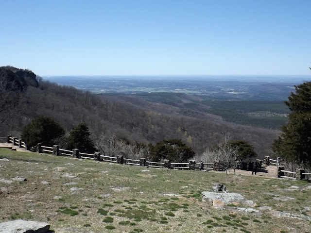
View from the first pullout on the scenic loop drive, Mt. Magazine State Park. Looking north.
Deb tries not to go airborne in a serious wind. The loop drive pull outs dish out some great scenery.
Heading down the south side we came to another scenic pullout looking in the opposite direction to our previous views (south this time), and just afterwards we came across a wonderful little waterfall. Then came the long drive (lots of back roads) to Little Rock, including our long and nearly fruitless search for coffee on the way. We were in contact with Luke, and now on our way to meet up with him at a Little Rock brew pub. Luckily for us we just happened to have a powerful thirst. Join me in Part Four for our Little Rock adventures.
Looking southeast on the downward drive on Mt. Magazine.
A characteristic section of Hwy 309, which crosses Mt. Magazine.
Hardy Falls is not signed, but can be seen from the road.
Deb's phone cam captures a solitary figure who noved in for a closer look.
Mapman Mike


