It was to be a day with a lot of driving, much of it on two-lane roads. Even a stretch of dirt road lay unknowingly ahead. 345 miles would be our total today, beginning in Tuscaloosa. We would head south for about 25 miles, then turn around and aim northwest for a long drive to the highest point in Mississippi. Then we would turn around and head to Leeds, a small centre just west of Birmingham. We would see some rain today, too.
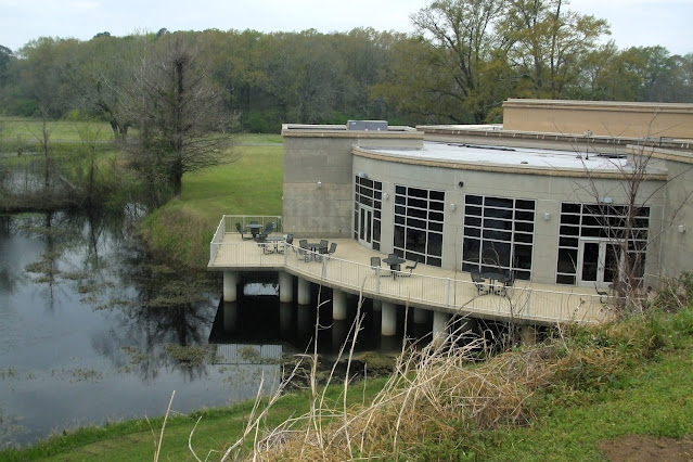
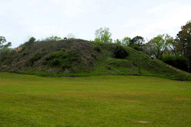
Like yesterday, we were already close to our first major goal of the day. Moundville Archaeological Park is just 25 miles southwest of Tuscaloosa. The site is easily as impressive in its scale as Poverty Point, though its dates are far less eye-popping. Though there was only one school bus today, it arrived with a full caravan of cars, trucks, and vans, at least one per family. The site is so vast that we were easily able to keep our distance. Deb went in to pay our admission while I chatted with a very talkative ranger. We didn't hike today, but drove to various locations in the park. We first headed to the museum complex, while the kids climbed the biggest mound.
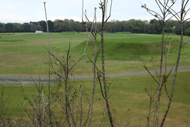
Today we visited the museum, Mound P, the Black Warrior River, and the large Mound B. We drove the loop twice, as it is a one way road. We passed the school and parent group at Mound B and continued on ahead of them to the museum.
Telephoto shot of the school group from the park entrance. Children are climbing Mound B, yet another day of ritual sacrifices.
A few things really stand out in memory from our visit to Moundville. Firstly, the site is vast. Secondly, there are a lot of still existing mounds, 34 in fact. Thirdly, the museum was nearly empty of artifacts, display cases standing empty. Alabama is currently in negotiations with various tribes regarding what can be displayed and what cannot. Fourth, the CCC did a lot of work here in the 1930s to restore the site. Fifth, there is an attached gift shop and cafe, with Mound P being virtually attached to the buildings. We climbed Mounds B and P, and undertook a short woodlands hike to a scenic overlook of the Black Warrior River. There is also a conference centre here, and a small village used for craft workshops and demos on special event days.
The site was largely abandoned by 1350 C. E. With distant kids talking and screaming both here and at Poverty Point, it was much easier to imagine the city alive with activity in its prime. Moundville is a major Mississippian ancient site. There are literally thousands of mounds from this period scattered around the landscape, but this is the most impressive of them.
The museum displays one of the most famous artifacts from prehistoric America, the Rattlesnake Disc. Found at Moundville.
Painting in the museum, an artist's conception of life in Moundville. View is toward the chief's mound, B.
After our visit it was time to drive north. Woodall Mountain is the highest point in Mississippi, lying close to the border with Tennessee to the north and Alabama to the east. It was a 3 1/2 hour drive, and was our only planned stop in Mississippi. It was raining off and on as we approached the drive-up location, but the rain was mostly on during our brief visit. It felt like a real mountain road as it climbed to the top, and a highpoint sign with guest book awaited. There are communication towers here, and not much of a view. It was chilly, windy, and very damp. After signing the book, Deb retreated to the vehicle. I took a short walk around the summit, just enough to activate our location on my Garmin GPS. Then it could be added to my Google Earth map. It was a long day of driving for a 15 minute stop.
Afterwards we had a fairly adventurous drive back down towards Birmingham. The rain soon stopped, but our trusty GPS soon had us on a dirt forest road, like those we often drive in NM. The vehicle soon acquired a suitable patina of sticky red mud, which mostly stayed on it for the rest of our trip. We stopped for take out coffee in a town called Muscle Shoals (?), at The Coffee Place, which doubled as a kind of pottery shop and art studio. The building was pink.
The drive improved once we reached Decataur AL, where I 65 lead us quickly towards our destination. We were aiming for a top notch brewery in Birmingham that also offered vegan food. We arrived at Back Forty Brewing Company at 5 pm on a Friday. Big mistake. The large pub was packed with people, with barely room to move inside. We left quickly, even as groups of people continued to arrive. We ended up at Ghost Train brewery, not far away. The place had craft beer, but it wasn't very good. They scored a zero for atmosphere (many sport TVs and not much else). No wonder few drinkers were here. We had one flight and left for Leeds, where our Comfort Inn awaited and, alas, another microwave dinner.
Ghost Train Brewery in Birmingham AL was a huge disappointment. Our first choice was crammed full so we left for here.
Mapman Mike


No comments:
Post a Comment